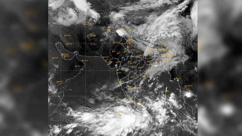
The first cyclone is likely to hit on May 6. Preparatory movements for Monsoon rains have increased in South-East Bay of Bengal. A low pressure zone is forming there and the possibility of it turning into a cyclone in the next 48 hours has been predicted by the Meteorological Department. International meteorologists have predicted the possibility of a cyclone in the second week of May, while the Indian Meteorological Department has predicted a cyclone in the same week.

A low pressure area was seen forming in the Bay of Bengal from May 2. It has now formed and is likely to turn into a cyclone in the next 48 hours. A fresh western cyclone is forming over northwest India from Friday night. A cyclone is forming on May 6. Since these two processes are happening simultaneously, a low pressure area will be created and the wind speed will increase. Therefore, when it seems that the unseasonal rains will stop, the journey of unseasonal rains is starting again across the country. So there is a possibility of rain along with storm.
Wind speed can be more than 50 in this condition. There is a chance of hailstorm in most of the areas. Due to the influence of Western Cyclone in North India and steamy winds from the Bay of Bengal over Maharashtra, the Meteorological Department has predicted the possibility of unseasonal rain in Konkan, Madhya Maharashtra, Marathwada and Vidarbha till May 6.
The impact of this cyclone is likely to extend from East India to Bangladesh and Myanmar. This cyclone is named ‘Mocha’ after the port of ‘Mocha’ in Yemen.
👉 Click here to read the latest Gujarat news on TheLiveAhmedabad.com


